

News Update
Florida Escaped 2021 Hurricane Season Unscathed, State Hopes 2022 Will Be The Same
CHRIS BONANNO
Journalist
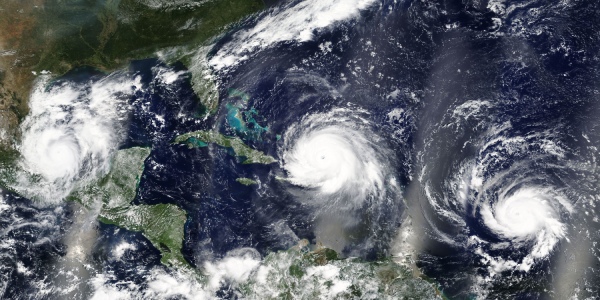
The 2021 Atlantic hurricane season, which officially ended Nov. 30, featured a bevy of activity with 21 named storms forming in the basin. Despite that, Florida was fortunate in that no hurricanes made landfall in the state during the season.
Still, Florida and in particular the Gulf Coast of the Sunshine State did see some impact with three tropical storms ultimately making landfall along with the northern Gulf Coast of the state. Portions of northwest Florida also saw impact from other storms.
“The steering currents did work out for us,’’ said Kevin Rodriguez, a meteorologist with the National Weather Service in Melbourne. “The way the Bermuda high pressure sets up across the central Atlantic and the western Atlantic really does impact us here in terms of where these systems will track because there’s always tropical waves coming off Africa every few days.”
Rodriguez added that the setup that was prevalent with the high pressure also was seen during the 2020 hurricane season as well.
“That’s a common occurrence in the summertime and fall as the monsoon season there gets going so wherever that high pressure sets up, in the last two years in 2020 and 2021, for the most part it’s toward the middle and latter part of the season,’’ Rodriguez added. “It’s been building westward or it has built westward. So, it’s basically pushed the storms either out to sea very early in their life cycles, where they come off of Africa and they turn right away. Or, they get pushed into the Caribbean and then they track into the Gulf of Mexico so they could still impact the Florida panhandle.”
Tropical Storm Elsa made landfall in early July in Taylor County as a strong tropical storm, according to weather.gov. The storm briefly reached hurricane status after it passed near the lower Keys but then lost it prior to landfall. It still made landfall as a strong tropical storm, with the vast majority of its impact felt to the north and east of the center.
“Elsa’s path was pretty well forecast. Stayed south of the islands, went between Jamaica and Cuba and then crossed western Cuba and then kind of up the far eastern Gulf of Mexico parallel to Florida,” Rodriguez said. “It did strengthen a little bit into a hurricane, but that was probably the hardest thing with Elsa was the strength. It did not strengthen as much as we thought it was going to. It’s always good when they don’t.”
Rodriguez also noted the copious amount of rainfall that southwest Florida saw in particular from the storm with isolated amounts as high as a foot with other areas receiving to 8-to-10 inches. An area stretching from east of Tallahassee to west of Jacksonville saw amounts ranging from 3 to 5 inches, with some isolated amounts perhaps higher than that.
Tropical Storm Fred made landfall just to the southwest of Apalachicola in mid-August. Fred, which made landfall with a 991 mb central pressure and maximum sustained winds of 55 knots (which
translates to just over 63 mph) regenerated after it had been downgraded to remnants as it impacted portions of the Caribbean but was able to re-strengthen in the Gulf of Mexico.
Tropical Storm Mindy also made landfall in the panhandle area, just a bit farther to the west than where Fred did so in early September as a minimal tropical storm. The storm formed not too far off the coast of Florida and only existed from Sept. 8 to Sept. 10.
On a whole, the season will largely be remembered for the impact that Hurricane Ida, which was a Category 4 storm, had when it made landfall in southeastern Louisiana in late August. According to noaa.gov, Ida was tied for the fifth strongest hurricane to ever hit the United States.
Though not hit directly, Ida did bring torrential rainfall to extreme northwest Florida, with several reporting stations recording rainfall amounts of more than 6 inches from near the Florida and Alabama border. The storm also brought gusty winds and a water rise along the coastline with a 2.43-foot peak inundation reported in Pensacola Bay from the storm per weather.gov.
Tropical Storm Claudette, which made landfall in southeastern Louisiana in June, also brought rain and wind to the panhandle, with the storm prompting tropical storm warnings to be posted for an area of coastline on the western portion of the panhandle.
The active season on a whole, which combined with 2020, featured the first-ever back-to-back seasons where all tropical cyclone names for the basin were exhausted, was in part fueled by a phenomenon known as La Nina, which is a cooling of waters in the eastern equatorial Pacific Ocean that has traditionally been known to promote active hurricane seasons in the Atlantic.